Where does soil erosion occur?

Despite the global nature of the problem of erosion by water, even today we do not have good information regarding the global extent of erosion by water. Data on the severity of erosion is also often limited.
Field observations — particularly the monitoring of eroding areas for several years — give the most reliable information on erosion. In a few parts of the world, measurements of erosion on fields and on plots are readily available. But this is not the case for the majority of the earth's surface. Remote sensing can also be a useful source of information on the extent erosion, but it tends to omit smaller erosional features which are not easily seen, and erosion which is obscured by subsequent vegetation growth. Another alternative is to use a soil erosion model to estimate erosion rates. This approach is attractive at first glance, but it is not easy to assess the reliability of results from such model-based studies
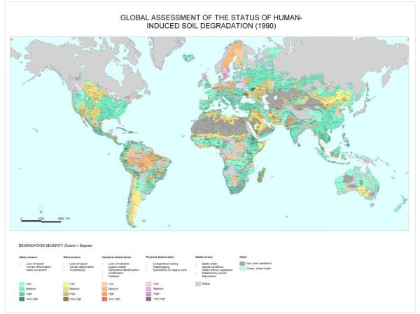
The GLASOD study produced a global map of soil erosion by consulting, using uniform guidelines, a large number of soil scientists throughout the world. The project estimated that around 15 per cent of the Earth's ice-free land surface is afflicted by all forms of land degradation. Of this, accelerated soil erosion by water is responsible for about 56 per cent and wind erosion is responsible for about 28 per cent.
This means that, world-wide, the area affected by water erosion is, very roughly, around 11 million square km., and the area affected by wind erosion is around 5.5 million square km. The area affected by tillage erosion is currently unknown.
Click for more information on the occurrence of erosion on each of the world's continents:
Dr David Favis-Mortlock, April 2025


